New England Map
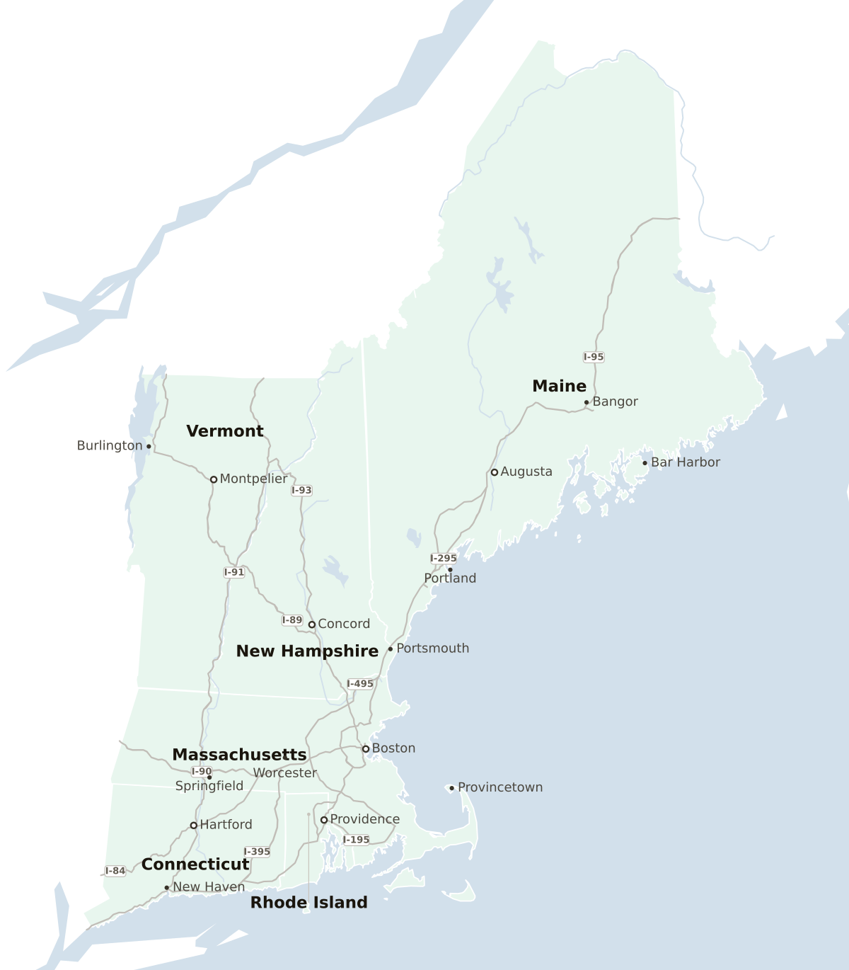
Map of the New England States
- Interstate and state highways reach all parts of New England, except for northwestern Maine.
- The greatest north-south distance in New England is 640 miles from Greenwich, CT, to Madawaska, ME, in the northernmost tip of Maine.
- The greatest east-west distance is 140 miles across the width of Massachusetts. This measurement does not include the bulk of Maine, which is larger than the other 5 states (New Hampshire, Vermont, Massachusetts, Rhode Island, and Connecticut) combined.
- The major coastal interstate is I-95. From New York City it courses through Connecticut, Rhode Island, Massachusetts, New Hampshire, and finally crossing coastal Maine.
- The historic but slower coastal road is Route 1 (Boston Post Road).
- Major inland highways include I-91, which shoots due north from New Haven, CT, to the border of Vermont and Canada, cutting through the middle of Connecticut and Massachusetts and running along the border of New Hampshire and Vermont.
- One major east-west highway is I-90, known as the Massachusetts Turnpike (or “Mass Pike”), which travels straight across the center of the state from Boston, MA to the New York border.